Argo measurements and climatologies
In the frame of the Cal/Val project scientific studies for calibration and validation are carried out. One of the main source of in situ data necessary for the cal val studies is the globally operating fleet of Argo floats (in the meantime 3000 floats). The Argo data are compared to climatologies, which were constructed based on the ocean data existing so far and describe the hydrographic state of the ocean. The RMS differences of salinity between the Argo data and the climatologies show the necessity of new salinity measurements and the reason to run the SMOS project. If the difference would be within the accuracy of the SMOS measurements, the SMOS data wouldn't provide any relevant information. Therefore, RMS differences should be higher than the precedented accuracy of SMOS salinities of 0.1 psu to provide new information.
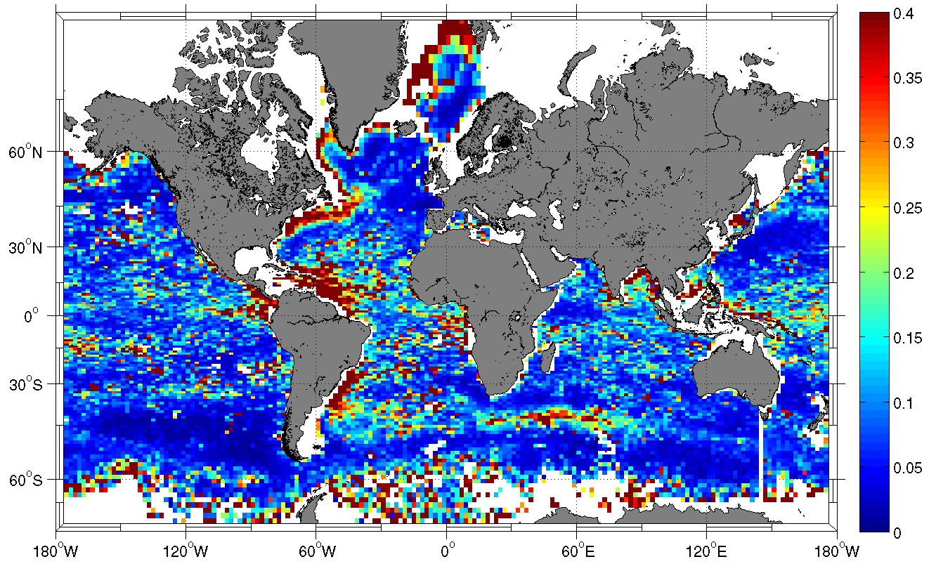
Figure 3 shows the RMS differences of the salinities originating from the last decade of Argo floats to a monthly climatology of sea surface salinity. The differences amount on most parts of the ocean 0.1 to 0.4 psu, and even higher values are found near rivers and their fresh water discharge. Strong differences are also shown along the axis of the North Atlantic Current and within the "Warm Pool" of the western equatorial Pacific, mainly influenced by strong precipitation.
The geographic distribution of the Argo float measurements is of enormous importance since it determines the adequate regions for validation studies, and if there are regions not representative and therefore not valid for SMOS data calibration due to insufficient data density.