Background
How the global water cycle is represented by the salinity at the sea surface and by soil moisture over the continents? This key question is being investigated in the frame of the European Space Agency mission SMOS (Soil Moisture & Ocean Salinity).
The ESA mission SMOS was planned with the aim of obtaining more precise data concerning the global water cycle: The exchange of water between land, ocean and atmosphere is one of the principal factors influencing weather and climate patterns. Evaporation caused by insolation is converted in the atmosphere to precipitation that will rain back down at a different location. Figure 1 shows the main components of the water cycle.
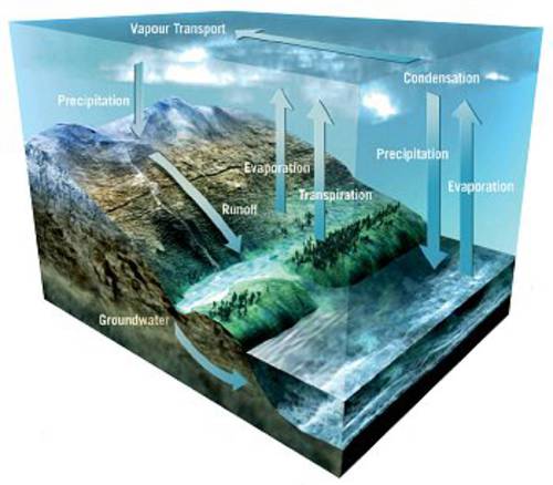
Figure 1: The water cycle
Evaporation and precipitation above the oceans affect their salinity levels thus changing the water density and therefore the current behavior. Salinity and temperature are the main controllers of water density that has a major impact on ocean circulation. Hence they have a dominant role in regulating our Climate. Figure 2 shows an illustration of the global ocean circulation that transports heat to the northern latitudes. Sea surface temperature is already routinely available from satellite measurements and sea surface salinity is an important additional factor for our understanding of ocean circulation.
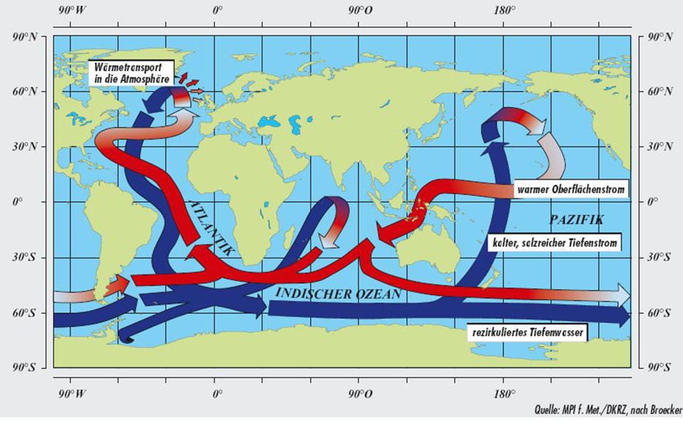
Figure 2: Ocean cirkulation, red: warm surface currents, blue: cold deep currents.
Measurements of soil moisture are valuable information for meteorological and hydrological modelling and thus of enormous importance for the prediction of extreme weather events and their effects. The water content of the soil has a direct influence on the water and energy fluxes on the earth surface. It determines the amount of evaporation of the surface and represents the available water reserve for vegetation growth. Furthermore the proportion of rain that directly enters a water body or that penetrates the ground depends on the already present soil moisture. In case of high soil moisture, less water will penetrate the ground so that intense precipitation may lead to floods. The high spatial and temporal variability of soil moisture are difficult factors for the measurement of soil moisture across a large area. Satellite data, such as from SMOS, have the potential to resolve that variability and deliver valuable information about the water content on the surface.
Integration into scientific programs
Soil moisture and salinity measurements correspond to the topics 2 (climate) and 3 (geosphere-biosphere) of "the Living planet“ program. They contribute enormously to research projects, involving seasonal and intra-annual climatic changes and processes. Different international scientific programs were originated to improve the understanding of the earth system with its influences on climatic events on the regional scales. The American Global Change Research Program (GCRP) combines different projects such as GEWEX and CEOP working on the same subject. GEWEX stands for Global Energy and Water cycle Experiments and aims at understanding the relationship of the different water cycle components to each other. It is one of the core programs of the research program WCRP and integrates Research and measuring campaigns in order to improve climate forecasts. The process of integration is implemented by the Coordinated Enhanced Observing Period (CEOP) and is based on a close cooperation with other projects and activities like the CLIVAR (Climate Variability and Predictability) study and the recently started CliC (Climate and Cryosphere) project. A high priority of these projects is the global measurement of soil moisture and surface salinity. Further programs that will gain considerably from SMOS are the LDAS and ELDAS (country DATA assimilation Schemes) programs of the USA and Europe.